TOOLS
The Observatory is an organization with a permanent scientific/ technical structure, capable of providing valid and updated information and documentation for critical phenomena, beyond the usual statistical reports.
A central element of the Observatory is the development of specialized know-how for the organization and operation of an Information System for Documentation, Data Management and Indicator Monitoring that enables recording, calculation, and monitoring of various indicators, as well as their geographical analysis.
• For the constant development and effective productive operation of the information system the Observatory comprises executives and associates with expertise and experience in physical planning, transport, environment, and information technology.
• The information system of the Observatory (hardware & software) provides an overall support to the automated and flexible management of statistical physical planning data and base maps.
• The credible productive operation of the Observatory is secured by processing and observing strict specifications regarding the range, quality, and validity of data input in the information system.
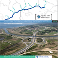
• The information system comprises the operation of a website on the Internet (https://observatory.egnatia.gr) through which Observatory products are shown and diffused in digital format. An electronic library and a base with supporting material and metadata have been developed.
• An ultimate objective of the system is to operate as a tool for decision-taking through the production of scenarios at a spatial impact level of a greater impact zone of the system of the Egnatia mainline and vertical axes.
The Observatory of the Egnatia Motorway disposes of a structured Information System of Documentation and Data Management which relies on the operation of a specifically configured Geographic Information System (GIS) and includes processed statistics and cartographic information relating to the Prefectures, the Regions, and the settlements in both the immediate and wider area of influence of the Egnatia Motorway and vertical axes. Both the function of, and the results produced by, the Observatory Information System depend on an infrastructure that is continuously updated:
• A Network of Computers supported by a Spatial Database Engine and equipped with specialized operating systems (GIS, measurement processing, statistics, graphics and Web development, production of documents etc) and peripherals (colour printers, plotter, scanner etc.). • Official data and processed statistical data of censuses and researches of the NGSS and Eurostat-REGIO.
• Environmental data on the basis of official data of the EU (Corine Land Use 1996 & 2000, RAMSAR, NATURA 2000 etc.).
• Traffic and Transport data (volume counts in the road network, road network composition, classification and evaluation data, data of Origin – Destination National Researches etc.).
• Digital files of Regional and Spatial Plans and Programmes, as well as EU data on Trans-European Networks (TENs-T), Pan-European Corridors (TINA), and policies – programmes of regional development:
• Spatial (GIS) data:
– A digital earth model (DEM, 3D),
– Aerial photographs, SPOT satellite pictures, and orthophotomaps,
– Administrative and geographical boundaries (NUTS 1-3, LUAs, FUAs, protected areas, CORINE land use etc.),
– Digital data WDC-ESRI,
– Updated Road and Railway Network,
– Updated Settlement Network,
– Updated Hydrographic Network and Coastline,
– Contour Network.
• Equipment of transport and environment measurements supported by a GPS.
• Electronic library and base for collecting supporting material and metadata.
|